
 |
| Ancient olive tree. Imagine the furniture that could be made with olive burl veneer. Gorgeous! |
After the city of Muğla we drove farther inland to Yatagan and turned northwest towards Bodrum. Our destination was a tiny mountain village occupied today by only 5 families.
 |
| Ruth outside Turkish Baths |
The name of this tiny village is Stratonikeia. Wikipedia identifies the village as Eskihisar, although the road signs were labeled Stratonikeia. The tourism pamphlet states that the village of Eskihisar has moved to a new area nearby, but that 5 families remain at ancient Stratonikeia. I suspect that the tourist pamphlet prepared locally is correct and that online information by Wikipedia is incorrect on this little matter.
 |
| Inside Turkish Bath, lower level. |
 |
| Inside Turkish Baths, upper level. |
The first scientific excavations at this site began in 1977 when digging was underway during the construction of a large nearby power plant. Probably the village residents had no idea they were living atop ancient ruins. (Where does all this dirt come from? All ancient sites are buried under 4 to 20 feet of dirt. Where does it come from when up at the top of a mountain?) Researching, excavating and restoration are in progress today ......... at a snail's pace, but still on-going. Judging by what we saw and the sketch of the original city walls, less than 10% of the site has undergone any excavation thus far.
 |
| Today's mosque for this tiny village of 5 families |
I cannot imagine being part of the 5 families that live in this village. Talk about isolation in antiquity! To call it a slow pace of life would be a gross understatement.
 |
| Wooden shade area over entry to mosque |
Thus far, the archaeologists have identified the city wall, city gate, gymnasium, temple, bouleuterion (Greek assembly place for council or public body), theater, Turkish bath, Big Tower, and the Roman Bath. Outside the city walls are found a water foundation (structure of unknown use but obviously Roman; visible alongside the main highway on the southern side) and a tomb. I found no information about the Big Tower or the tomb. We know where these 2 things are physically located, but don't know the who, what, why or when.
 |
| Ruins of the gymnasium looking one direction |
Too little is yet known from the archaeologists to identify with certainty when this city was first built. The oldest item found on the site thus far dates back to the 12th century B.C. It is a stirrup cup, buff in color with red stripes. A stirrup cup was a small cup presented as a gift when a guest departed. A parting gift.
 |
| Ruins of gymnasium facing opposite direction |
In researching online about this site, I found this article about an item excavated there just this year. Also learned that items from this site have been brought to the Museum in Mugla, so maybe we should not have skipped that museum. But you can only see just so much in a single day trip. January 2012 discovery at Stratonikeia
 |
| Any ideas what these shaped stones might have been used for? Many, many piles of odd stones everywhere |
This city was first known as Idrias and then Chysaoris and is pre-Hellenistic in origin. The name was then changed to Stratonikeia, which was sometimes spelled Stratoniceia. It was one of the most important cities in the interior of Caria. (Remember, the Carian people were those who bridged the gap between primitive peoples and modern peoples; lived in caves and then stone buildings; invented embroidery and numerous musical instruments.)
 |
| Purpose of this? Circle was about 2-ft diameter. |
King Seleucis of Syria transferred control of the city to his son Antiochus in 294 B.C. King Seleucis was married to a woman named Stratonice. Later, Antiochos married his stepmother and he renamed the city for his wife/lady stepmother. King Antiochos I changed the name of the city from Chysaoris to Stratonikeia in 281 B.C.
 |
| This stone looked like it might have been used for sacrifices. There was a groove chiseled out that would have drained blood off the end. |
According to the tourist pamphlet, "under the Prohibited Degrees a man may not marry his stepmother; but in the Hellenistic royal families this matters were otherwise regulated." By my research this does not appear to be true.
 |
| Underside of the stone that looked like a sacrificial place was intricately carved. What was this? |
Roman civil law prohibited marriages within four degrees of consanguinity (blood relationship). This was calculated by counting up from one prospective partner to the common ancestor, then down to the other prospective partner.
The first prohibited degree of consanguinity was a parent-child relationship; a second degree would be a sibling relationship. A third degree would be an uncle/aunt with a niece/nephew; while the fourth degree was between first cousins. As there was no blood relationship (consanguinity) between the step-son and step-mother, there should have been no legal objections with this marriage per the Prohibited Degrees.
 |
| Billa House. I have no idea what the Billa House is or why it is important, but it was mentioned in all the tourist literature and on most websites I checked. |
Little is known with certainty about this city except for the location of the city wall. Based on the sketch in the pamphlet, we walked only a tiny percentage of this site. The city appears to have been laid out in a grid plan.
 |
| A very tall column. Note how deep is the base -- buried over time about 6-ft. Where does all this dirt come from. Couldn't be silting because this is at top of a mountain with no water source nearby. |
One of the first things excavated in 1977 was the gymnasium. The narrow side is 105 meters wide. The long side was 180 meters in length. It is the largest known gymnasium in antiquity. Finds at the site indicate that the gymnasium was built circa 125 B.C. There were so many stone pieces tumbled about in the gymnasium area. We spent much of our time investigating this area.
The agora (wide plaza area with columns on either side and merchant/vendor shops on either side) was partially excavated.
 |
| Intricately carved posts--must have been entryway for a street leading to something or someone important. |
 |
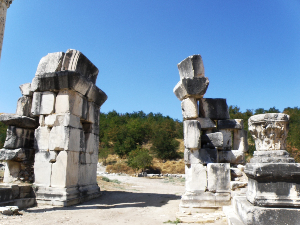
| Gate to Boulerion (not to temple area as originally thought) |
Out in an open field stood a 'gate' -- which means carved stones placed to resemble a doorway opening. It was first thought that this gate was the entrance to the penbolus or precinct surrounding the temple, an enclosure over 100 yards square, of which very little else has been located to date. We saw no evidence of digging in that general direction. Farther past that area is the temple. The Serapeum, or a temple dedicated to the cult of Serapis, was built around 200 A.D. and is full of inscriptions and invocations to the gods. This period was right on the cusp of the Romans' conversion to Christianity. The location of the very much older temple of Zeus Chrysaoreus is known to be on the site somewhere but its locations remains unknown.
 |
| The Boulerion |
 |
| Pomegranates and figs grew by the thousands all over the site. Continual growth since antiquity? |
 |
| That must have been one huge column! Waist high diameter. |
 |
| Wandering ancient walkways |
 |
| We're the Fugari. (Sound it out) |
We also did not linger at the Roman baths. Nor the Turkish baths. Although the very first thing one encounters upon entry to this site from the parking area are the Turkish baths. Right next to the current mosque. Very close to the current little 'village square' and across from the 'village coffee shop' that was recently restored by the Young Men's Business League in the nearby city of Yatagan. We did stop there for drinks and snacks before departing.
 |
| The colonaded street. |
We wound around through rock walls and paths and eventually found the colonnaded street and monuments. Randal wanted to see some mosaics that were in this area.
 |
| Plastic covered mosaics |
Unfortunately, most of the mosaic areas were covered by plastic sheeting for protection from the elements. The archaeologists had placed barrier tapes to discourage visitors from disturbing the mosaic areas. So we didn't really get to see much of the mosaics.
 |
| Overlooking towards valley. The Necropolis was located down that way. Someday will be a lake. |
The view down to the valley was breathtaking. This must have been a beautiful place.
The road outside the city wall leading up to the Northern City Gate was called the Holy Road. It also led down to the city's Necropolis. The Necropolis is gone today, destroyed in recent years by coal mining for the nearby Yatagan Power Plant. When all the coal has been depleted, the low-lying areas will be submerged when a man-made lake is created. That will really nice for this area --a large mountain lake.
 |
| The North Gate as it stands today |
At the end of the colonnaded street stood the northern City Gate and Fountain.
 |
| The fountain pool. Floor is covered in mosaics. |
 |
| Clay water pipes visible in many places. These led to the fountain pool beside the North Gate. |
 |
| The North Gate as it looked during ancient times (per the tourist brochure). Wouldn't it be great to see this fully reconstructed. |
 |
| Mosaic pattern in floor of fountain pool. Long before German Nazis. We have seen this same symbol used by Kuna natives in Panama and on a couple of South Pacific islands. Wonder how this symbol became used worldwide before global travel was possible. |
 |
| Mosaic pattern in floor of pool. Tridents. |
 |
| Mosaic pattern in floor of pool. Pomegranates. |
 |
| Outside mosque entry, below ground level. This looked like water would flow through. Appeared a perfect place for early Christian baptisms, although nothing in our tourist literature mentions Christians ever inhabiting this area. |
When I researched Stratonikeia (after we visited), I was shocked to learn about its Christian history. According to Wikipedia, Stratonikeia was Christianized early. It was a Titular See. The Notitae Episcopatuum mention the See up to the 13th century among the suffragans of Stauropolis. Only 3 of its bishops are known, by their signatures at councils: Eupeithus, at the Council of Chalcedon in 451 A.D.; Theopemptus at the Council of Constantinople in 692 A.D.; and Gregory at the Council of Nicaea in 787 A.D.
(Now, THIS is what shocked me.)
Stratonikeia remains a Titular See of the Roman Catholic Church, Latinized as Stratonicensis in Caria. The Seat has been vacant since the death of the last bishop in 1977.
In a secular country that is 99% Muslim. And in a village inhabited with only 5 families, all of whom are Muslim. Think it might be time for the Catholic Church to update their records?
 |
| Village Coffee Shop restored by the Young Businessmen in nearby larger city of Yatagan. |
Ruth was hungry and the rest of us were hot and thirsty by the time we finished exploring the North Gate area and trekking the long way back to the entrance. So we stopped in the village coffee shop/cafe to see what could be purchased in the way of libation and nourishment.
 |
| Randal and Bill |
 |
| Ruth waiting for her Tost |
Ruth ordered a Tost; I gulped down 2 bottles of water; and Bill and Randal enjoyed cold beer. (Tost is a popular sandwich, found literally everywhere in Turkey. Usually has a slice of cheese, a slice or 2 of tomato, and maybe a slice or 2 of some kind of beef deli meat. Placed between 2 slices of bread and placed on a grill with a weight on top to squish it down. No butter or oil; cooked dry. This is pronounced just like our normal toast.)
 |
| We shared the coffee shop with one of the local chickens. |
No comments:
Post a Comment
Your comment will be posted after we confirm that you are not a cyber stalker.