TRANSLATE, TRADUIRE, ÜBERSETZEN, TRADUCIR, 翻译

Saturday, September 22, 2012

Castle of St. Peter and ancient Halicarnassus (Bodrum)

As always, click on any image for larger view.  The photos are scattered in this posting and not necessarily associated with adjacent text.  The photos have explanatory captions.

We stayed in pretty little the Kuruca Buku anchorage for only one night.  By 06:45 on 14 September the anchor was up and we were headed out of the bay.   As usual, winds were predicted but never arrived.  We motored the entire 49.7 nautical miles up to Bodrum.  This is as far north as we are venturing by boat this year.   After Bodrum we will work our way south and east over 3 to 4 weeks down to Fethiye where we will dock for the winter.  That is roughly 100 NM as the crow flies, so we are not in a hurry and kind of lazing along.

Castle of St. Peter in Bodrum


In Bodrum we dropped the hook at 37.01.704N  027.26.005E in the main anchorage just east of the castle.  That castle and the acclaimed Bodrum Museum of Underwater Archaeology were our only reasons for coming north to Bodrum.  


Inside main body of castle
This museum is rated as the best marine archaeology museum in the world.  Artifacts from shipwrecks back as far as 1600 B.C. are displayed here.  Imagine our surprise to learn during our visit the next day that this particular ancient shipwreck had been excavated by a team from Texas A&M University, the school preferred by many of our family members.  Another shipwreck from 500 B.C. was also excavated by a team from Texas A&M.  Who knew!  I know that University of Texas is active with excavations, but did not know that Texas A&M funded and participated in overseas digs.  Maybe A&M does just the underwater excavations?   Would sort of fall in line with their Marine Engineering programs, both marine related topics of study.  Another shipwreck exhibit that I was particularly interested in seeing was the recovery of the remains of a ship and its contents from Serce Limani.  We have visited Serce Limani numerous times and are familiar with the exact spot where this small trading ship sank in 1042 A.D.
Ancient olive oil press

Cafe overlooking our anchorage
Our anchor spot was chosen with care.  Every single person who has spoken with us about Bodrum has emphasized how incredibly loud the bars are here.  There is a particular bar called the Catamaran Bar that is right at the base of the castle.  It is an enormous catamaran, but it is permanently affixed to the shore.  It starts rocking around midnight and booms through the anchorage until around 04:00 each morning.  We did not want to be anchored too close to this!  So we anchored well out from shore practically in the middle of the wide bay.  Turns out there are plenty of other bars along that long shoreline that are just as loud as the catamaran. 


Interesting history of coins; click on image to enlarge to read
 We ‘enjoyed’ music until 04:00 from 4 bars in all directions that seemed to be competing with one another as to which could be the loudest.  Ahhh, but we have a solution to this madness.  We have two 24-volt fans mounted on a piece of starboard.  These are the kind of fans that truckers used to cool their truck passenger cabins before all trucks became air-conditioned. The starboard fits perfectly on the deck outside our aft cabin between the rear-facing hatch and the deck lid for the stern lazarette; this fits snugly and does not shift with boat movement.  Heck, we can even sail with this in place as long as seas are not splashing over the stern.  Bill put an extra long power cord to the fans.  He made this to suck in air to help ventilate and cool the aft cabin because air obviously does not blow into a rear-facing hatch when a boat is always pointed into the wind when at anchor.  An added benefit to these fans is they provide white noise, especially when switched on ‘high.’  We rigged up the fans and also turned on the other 2 fans in our rear cabin, and the white noise of all 4 fans blurred out 90% of the bar noise.  Bill slept like a baby.  Me, less so; but enough to have sufficient energy to tour the castle the next day.  I could feel the booming bass more than actually hear it.  Bill never noticed it.

The Fisherman
Bodrum is the site of ancient Halicarnassus.  More about that later in this posting.  Today Bodrum is a bustling center of activity.  It has been called the “St. Tropez of Turkey” and has a cosmopolitan feel.  All of this hustle and bustle came to Bodrum quite recently.  Until a decade ago it was a remote fishing village that was easier to get to by sea than by land.  New roads were built and the travel time via land from the nearest large cities was cut by 90%+.  With the easier access, Bodrum became popular.  When the Turkish Republic was formed in 1923, Bodrum became a place to exile dissidents to the new republic.  One such dissident was Cevat Sakir Kabaagac, who soon earned the title “the Fisherman of Halicarnassus.’  Not because he was literally a fisherman, but because he was a fisher of stories.  His tales of Bodrum and its local characters became famous in Turkey.  Others followed ‘the fisherman’ here and the village soon had a reputation for being a bit bohemian. 
Wise footwear choice for uneven stone castle stairways?

Overlooking marina and harbor at Bodrum to west
In the 1970s the rich and those ‘in the know’ in Istanbul and Izmir followed the writers and artists here, and the village developed into a small resort.  The building code limits structures to no more than 3 stories, which has helped preserve the traditional look of the city as it has grown exponentially.  No developments of huge apartment blocks here.  Just the typical squared white-washed building climbing up the hillsides.  Tourism here started to develop on an international scale in the 1980s and 90s. 


 The founder of Atlantic Records purchased a sumptuous beach manse directly in the heart of the city.  Each summer he would bring a coterie of international celebrities down to the Aegean to indulge in the sand, sea and sun.  This ushered in a new era that has slowly transformed the relative backwater haven for misfits into a star-studded see-and-be-seen paradise rivaling the likes of St. Tropez and St. Barth.  Supposedly, several international celebrities have purchased holiday properties here.

Overlooking the English Tower to Bodrum to the east.
S/V BeBe is anchored in center
I had wanted to shop for a few specific galley provisioning items rumored among cruisers to be available only in Bodrum.  But that proved more trouble than it was worth.  We asked several people for directions to the large Migros and Metro that supposedly are located in Bodrum, but neither of us could understand clearly where they were directing us.  We did manage to find the dolmus (local bus) center but that didn’t help since we had no idea which color dolmus to take.  Never saw a taxi.  So I said the heck with it; we could live without those specialty items.  I was already tired of walking on the uneven stones and we had an entire afternoon of that ahead of us. 


Probably 90% of the tourists stopped to take this exact
same photo when they passed this statue sans head. 

The castle exhibits are closed from 12:00 to 13:00, so we grabbed lunch and then returned to the castle at 12:45 to begin our afternoon of sightseeing.  Timing was perfect to walk through the first areas of the castle and arrive at the exhibit rooms just as they re-opened for the afternoon.  There was a very large cruise ship in port and the whole town was buzzing with tourists.  The Castle of St. Peter was crowded but we managed to stay a few minutes ahead of the worst of the crowding all afternoon as we progressed through the huge castle.

Hundreds of amphorae of all ages
New amphorae

The collection of amphorae is impressive.  All excavated from shipwrecks spanning from 14th century B.C. to present day – all recovered from waters of southwest Turkey.  Different shapes and sizes were on display.  To my untrained eye it seems as though the older the shipwreck, the larger the amphorae.   The oldest ones were about waist high, about the size of an oil-drum barrel; the ones from 500 A.D. to 1,000 A.D. were like 5 to 10-gallon size.  A couple displayed are brand new.  Near Ephesus there is a training center that teaches some of the ancient skills and working trades.  Tourists can buy the replicas produced there.  They still make amphorae in the ancient way.  Those displayed here are painted as it is believed amphorae were decorated way back when.
Watching video about excavation of 1600BC shipwreck.
Notice how large the amphorae were in this oldest ship

Stone circles used as lining of water well

At least half-dozen water wells inside castle
It was also interesting to see how water wells were lined back then.  I had never thought about this but quite obviously water wells would have had to be lined with something.  Some things never change.


Info on the castle chapel, click image to enlarge to read

The Knights of St. John arrived here in 1402.  When they arrived, ancient Halicarnassus was in ruins, presumably destroyed by an earthquake.  The knights found the large quantity of marble from the ruined buildings a useful source of building materials for the castle.  You can see bits and pieces of marble in the walls.  The resulting Castle of St. Peter built by the Knights of St. John has remained virtually intact.  It is amazingly well preserved.  By far the best preserved (not reconstructed) castle that we have visited to date. 
Chapel inside the Castle of St. Peter, later converted to a mosque;
now houses a shipwreck replica exhibit


Sitting under the mulberry tree


Outside the chapel inside the castle proper stands a very old mulberry tree.  Bill opted to sit in the shade of the tree and rest while I checked out all the amphorae, water wells and the chapel interior.  Inside the chapel is a replica of yet another shipwreck, this one not nearly as ancient as the ones we found most interesting.  Near the mulberry tree was a plaque explaining a legend.  

The plaque reads:  

"There are 3 types of mulberry tree found in the Anatolia region of Turkey.  These are the red, white and black.  Originally from China, it is believed these came to Anatolia in the 12th century AD.  A legend tells of 2 young lovers, Thisbe and Pyramos, who were to meet under a mulberry tree.  While waiting for her lover, Thisbe was surprised by a lion.  Making her escape, she left behind her shawl.  When Pyramos arrived he saw the blood-stained shawl.  Fearing his lover dead, he killed himself with his sword.  Thisbe returned, and seeing Pyramos dead, killed herself.  The gods watching the tragic fate of the 2 lovers decided to plant the mulberry tree all over the world."

Per our sailing guide book “East Aegean” by Rod Heikell:

“The Order of St. John of Jerusalem was born in the 12th century in the dust of Jerusalem and the blood of the Holy War.  Originally the order was purely a nursing brotherhood providing hospitals for the sick and wounded.  Later its duties were extended to the defense of pilgrims visiting Jerusalem and it is from here that its military side appeared.  In 1291 the knights were compelled to leave Palestine with the collapse of the last Christian stronghold and they went first to Cyprus and then to Rhodes.  In Rhodes they developed new military skills and became sailors. 
a Blessing Goddess was carried on each
ancient ship for good luck


 In their swift galleys, these Christian corsairs became a respected and feared fighting force along the coast of Asia Minor.  After Rhodes the knights established a string of castles on the islands of the Dodecanese and then turned their attention to Asia Minor.  The site of Bodrum, where an earlier Seljuk castle had stood, was perfect; and construction began in 1402.

The layout of the castle roughly followed the divisions of the order into 8 Langues or tongues, the 8 European nationalities from whom the knights were recruited.  These were Auvergne, Provence, France, Aragon, Castile, England, Germany and Italy.  In the Castle of St. Peter there are 4 towers: the Italian, French (incorporating Auvergne and provence), German and the English towers.  I assume Aragon and Castille were accommodated in one of these towers or were not represented in this castle at Bodrum.

French Tower and Italian Tower

The knights of the order were all men of noble birth from the great houses of Europe.  To be recruited the noble blood had to be traced through 4 generations and any possibility of illegitimacy or common blood in the line barred a man from joining.  Once accepted, the novice knight served on the military side for a year, usually in the sleek galleys.  One year of duty in the galleys was called a ‘Caravan’ and after 3 ‘Caravans’ the knight had to reside for a further 2 years in the order in somewhere like the Castle of St. Peter before he was a fully-fledged Knight of St. John. 


Info on the English Tower
After this, many would return to their estates in Europe; but on being summoned by the Grand Master in times of crisis, it was their duty to return.  There were lower orders with no restrictions on birth, the Chaplains and Brothers, who served in the hospitals and with the soldiers on the military side, all of them along with the knights bound by those medieval dictates of chastity and obedience.  At their best these knights probably came as close as any to the ideal knight imagined by romantics, what Chaucer called the ‘verray parfit gentil knight’ but they were also a skilled fighting machine as brutal and cruel in battle as any foe they fought against.

Exterior of the English Tower
Carving of a lion and coat of arms


The knights occupied the Castle of St. Peter until the fall of Rhodes to Suleiman the Magnificent in 1523.  Suleiman allowed the Knights of Rhodes to leave the Castle of St. Peter; he considered them gallant adversaries whose lives should not be wasted and is reputed to have said of the Grand Master ‘……it is not without some regret that I oblige this old Christian to leave his home’.”


Interior English Tower


(Thanks Rod and Lu for that little history lesson!  FWIW, we met Rod and Lu on S/V Skylax in the South Pacific and anchored next to them several times.  We participated in a SSB net with them while sailing from Cairns to Singapore.  Nice and friendly people.  Bill and I had no idea when we were associating with Rod and Lu that they were the authors of such renowned worldwide sailing guides.)


Interior English Tower
The castle was abandoned by the knights without ever having truly tested its fearsome defensive capabilities.  The castle then fell into decline during the succeeding centuries and suffered some shell damage during WWI.  Reconstruction began in the 1960s when it was used as an informal storage space for the booty collected during underwater archaeology missions.  The castle required surprisingly little reconstruction.  The storage booty continued to accumulate and in 1986 the Museum of Underwater Archaeology was established.


sketch of  1600BC anchor

The original Rocna anchor, circa 1600 BC

We enjoyed the nautical museum exhibits.  Saw lots of interesting things.  It would be difficult to say which was the most interesting.  The ancient anchors were new to us.  Bill declared one to be the original Rocna.


French Tower and Italian Tower
Bill and I walked the entire castle – up, up and up……down and back up…..down, down and down……around and around….noting many Crusader Coats of Arms carved in stone mounted at various spaces throughout the castle.  

I think we saw everything except the dungeons.  Saw a sign for the dungeons but never found them.  And by that time my hip and knees were hurting too much for me to really care if we ever found the dungeons.  Walking on uneven stones for hours does a real number of aging joints.  Bill declared once again that he is so totally done with castles and ancient sites of old rocks.  I’ll give him a break for a few weeks, but we are going to Cappadocia next month; so he will have to endure at least 1 more visit to see old rocks.
The original notebook.  Also called a writing board.  This
was about 4"x6"; made of boxwood with ivory hinges.  The
recessed areas on each side were filled with beeswax and
writing was done with a stylus.  First mentioned in The Iliad
by Homer, his only reference to writing.  Found in the
excavation of the 1400 BC shipwreck.

Cylinder Seals and examples of the images these produce when rolled on wet clay. These are circa 1750BC
and were about 400 years old when the ship sank  around 1400 BC.  These were used as a form of personal
identification in the Near East.

Miniature Sphynx mounted on column
Now a bit of info about ancient Halicarnassus, a/k/a Bodrum today.

Halicarnassus was the site of 1 of the 7 Wonders of the World and it was also the capital of Caria, but precious little remains of it today.  There are bits and pieces of ancient marble strewn throughout the city and incorporated in buildings and gardens to a very pleasing effect.  It is neat to walk around and see bits of ancient carvings and pillars used as doorsteps or garden decorations.  As the guidebook states, “the city is a palimpsest in which bits of old history poke through into the modern world.”

Halicarnassus was established as a Dorian city by the colonists from the Peloponessus around the beginning of the 10th century B.C.  Makes me wonder why the Peloponians came due west hundreds of miles across the Aegean Sea to relocate here.  Hopefully we will learn more about that next summer when we go through the Corinth Canal over the northern side of Peloponessus. . 
Herodotus--the father
of written history

Herodotus, ‘the father of written history’, was born here in 482 B.C.  Herodotus is called the father of written history because he wrote a 9 volume history of the wars between Greece and Persia.  Think about that for a second.  This man wrote 9 books on the subject of history in the 5th century B.C………yet the entire library of King Henry VIII in England about 2,000 years later supposedly consisted of only 3 books and those were about religion.  Herodotus stands apart as an early writer because of his ability to arrange his material systematically and to look critically and impartially at his sources.  He was surprisingly free of racial prejudice and his appreciation of the personalities he wrote about and his awareness of the foibles of human nature elevate his writings way above other early authors and many later authors.  After traveling throughout the entire known world of that time (Europe, Africa and Asia Minor), he returned to Halicarnassus.  But he did not stay long.  He left after disagreements with the Dynasts and he spent the last years of his life in Thuria in Italy.

Excavated 1042 AD shipwreck from Serce Limani.
This ship was same length as our boat.
Again, as Rod Heikell writes in “East Aegean”:

“It was the Dynasts who were to put Halicarnassus squarely on the map of the ancient world.  In the 4th century B.C. the region was in Persian hands and ruled by local satraps.  In 377 B.C. Mausolus took over and set about making Halicarnassus the capital of Caria.  He cannot be accused of mean ideas (low cost or small ideas); he constructed 3 ½ miles of fortified city walls, the remains of which can still be traced on the western side of the town.  


Islamic glass recovered from the Serce Limani shipwreck.
Flash photography was prohibited in this exhibit.  The
glass was beautiful delicate mottled pink & blue colors.


Mausolus enclosed the harbor we see today and had a canal dug across the isthmus that now connects the castle to the mainland.  He built temples and the theater that remains today on the hillside above the main road to Gumbet.  And for himself he built a large palace of sun-dried bricks decorated with marble from the Sea of Marmara.


Arabic bowl with Kufic inscription reading 'yumn'
Recovered from the 1042 AD Serce Limani shipwreck
When Mausolus died he was succeeded by Artemisia, his sister and wife.  It was a common practice for a king to marry his sister as the Pharaohs did in Egypt.  In his memory Artemisia constructed the magnificent tomb of Mausolus which became 1 of the 7 Wonders of the World.  It also gave us the word ‘mausoleum.’  The tomb was planned by Mausolus himself and designed by Pytheos, the man who also designed the Temple of Athena at Priene.  
Another Arabic bowl from the
1042 AD Serce Limani shipwreck


The mausoleum was an enormous white marble tomb topped by stepped pyramids.  It stood intact for almost 19 centuries according to the Lonely Planet travel guide; until it was broken up by the Crusaders in 1522 and the pieces recycled as building material for other structures.  Rod Heikell’s books report that the mausoleum was reported to be still intact in the 12th century, but when the Knights of St. John arrived in 1402 it was in ruins, presumable destroyed by an earthquake.  So, maybe the mausoleum stood intact only 16 centuries instead of 19; either way, an impressive structure that lasted a very long time. 


The mausoleum stood 50 meters high and 20 meters long, with the whole edifice adorned with magnificent friezes.  For my American friends, that is 162.5 feet high, or the equivalent of about a 6-story building; and 65 feet long.  That was a huge tomb!

Nefertiti
What's up with that eye!
(Side note from one of the castle museum exhibits:  The image above is a copy of Nefertiti from Tell el-Amana in Egypt.  One of the smallest artifacts found on the seabed of the excavation of a 1200 BC shipwreck was a wron scarab of pure gold inscribed in hierglyphs with the name of Nefertiti.  It is the only gold scarab of the Egyption queen ever discovered.  This scarab was already old when the ship sailed.  Nefertiti was the wife of Pharoah Akhenaten.  After their deaths, conservative priests tried to erase all mention of Nefertiti's name and that of the heretical Pharoah Akenhaten, who has introduced monotheism to Egypt.  The priests wanted to retain the traditional many gods of Egypt and refused to accept the concept of a single diety.  Now, back to ancient Halicarnassus.) 

After the death of Mausolus his sister-wife Artemisia ruled for just 3 short years.  But during that time she proved to be a formidable successor to her brother-husband.  When the Rhodians learned that a woman now ruled Halicarnassus, they decided the city would be easy for their forces to take.  When the Rhodian navy entered the harbor Artemisia led her fleet out of a secret canal on the eastern side and counter-attacked from the rear ------ routing the Rhodians and capturing their ships.  Not content with simply defeating the Rhodians, she sailed the ships back to Rhodes.  Those who had been left behind in Rhodes saw their returning ships and believed their navy had been triumphant.  So the Rhodians put up no resistance to the arriving Artemisia.  She captured the city.  The Rhodians, over-awed as well as overwhelmed by this Amazon-like Queen, erected a statue in her honor.
Evolution of early anchors

Halicarnassus was largely destroyed by Alexander the Great in 334 B.C.  The people refused to surrender so Alexander in his methodical way destroyed the city.  After a long and fierce siege the defenders set fire to the city and retreated to 2 strongholds on the east and west of the harbor.  Alexander sacked the city and left a detachment of troops to blockade the defenders.  The defenders surrendered a short time afterwards.  Between the fire and Alexander’s troops sacking the city, much of it was destroyed.  It never fully recovered and declined in Byzantine times.


Various types early anchors

We stayed 1 more night in the noisy Bodrum anchorage.  Decided there was nothing else in Brodum that warranted staying any longer for sightseeing or shopping and we moved on.


No ancient site tour is complete with a visit to the latrines.
The latrines were up on the 3rd level of this big castle.
And, of course, one must have mosaics on the floor.
These are Byzantine, circa 500 AD

Friday, September 14, 2012

Finally out cruising

As always, click on images for larger views.
Mountains as far as the eye can see
We finally left Yat Marin marina in Marmaris on Saturday, 1 September.  Predictions were for light winds, which they were.  Always on the nose, of course, since this is the Med.  Every time we neared a change in course which should have put the wind at a good angle for sailing, the contour of the land and mountains caused the wind to change direction too, always putting it right back on the pointy end of the boat.  In the afternoon when we made the turn north around the peninsula to head toward Datca (pronounced DAH-cha), the wind was almost on an angle that we could sail.  Not quite, but almost.


Bosburun as seen from our anchored boat


So we changed destinations to a direction that allowed us to sail, and headed toward Bozburun instead of Datca.  Those fabulous sailing conditions lasted a whopping 15 minutes!   Wind died to basically nothing; we furled the sails; and motored up to Bozburun.  Total mileage for the day was an easy 40 NM.  Dropped the hook at 36.41.365N  028.02.563E for those readers with either electronic charts or Google Earth.  


Bosburun anchorage---Turkish girl learning to sail


This is a great place!  Swing anchorage; small town with decent small markets for fresh produce and basic provisioning items.  And even a limited selection of chandlery items.  A small sailing charter company bases out of Bozburun so there are plenty of quayside restaurants, as well as several resort hotels along the shoreside.  Boats can go inside the small harbor to dock wherever space is available, but we prefer to swing anchor.  We stayed there 4 nights.


Near Bosburun is a wooden boat building yard.  Inside
this gigantic building they are building the largest
wooden boat in the world for a very rich Arabian man.


A group of cruisers in Marmaris were planning a lunch outing at a bayside restaurant in Keci Buku (a/k/a Goat Bay -- pronounced KETCH-ee BOO-koo) near Oranthiye on 6 September.  We decided it would be fun to join them.  They would arrive by bus; we would arrive by boat. 
Leaving Bosburun anchorages


So, on Wednesday 5 Sept we motored 18 NM farther north to the very lovely bay with the sand spit down the center.  We had seen the Keci Buku bay from the mountain road last year when we shared a rental car one day with Jackie & Brian on S/V Songster and drove out Datca peninsula.  This was our first time to visit this bay by boat.  There are several choices of anchorage in this bay, plus several catwalk docks in front of small restaurants at the head of the bay behind that sand spit.  As we motored past Marti Marina we noticed 3 boats anchored just west of there.  That looked like just a good a spot to anchor as any other place, so we dropped hook at 36.45.922N  028.07.659E in 10 meters depth.  We would have a longer dinghy ride into the restaurant, but we were happy out there.  Good breezes; not crowded; and had a lovely view of the tiny island with the ancient fortress on top.


Trying to plan the rest of our time in the Med.  This is incredibly
 frustrating because of the 90-day Schengen Treaty visa limitation --
90-in then 90-out.  Not sure the Med is worth this much worrying.
We also had wanted a closer look at Marti Marina.   After that closer look, we continue to be baffled as to why this particular marina is so expensive.  What is the attraction to warrant the high prices?  We had emailed the marina in late July to inquire about berthing space for a few days.  Price for our 16-meter (53-ft) boat was $1,046.25 USD for one week.  We responded; thanks, but no thanks.  Bill told them their rate was too expensive for us.  We think the marinas will continue to increase pricing to whatever the market will bear.  Someone has to tell them when they have reached the price that exceeds what the market will bear.  Obviously, many people are willing to pay that high price because the marina appeared to be full.  But we are not paying that!!  Especially with so many anchorages nearby.

BTW, while motoring from Bozburun to Keci Buku we passed a fjord-like bay on the left that is called Bencik.  There is an interesting little story about this place.  At the head of the long Bencik bay the Dorian Peninsula is at its narrowest point.  Knidos is situated on the western tip of that long peninsula.  The 5th century B.C. historian Herodotus wrote that when the ancient Knidians who inhabited this area were threatened by the Persians, they set to work to dig a canal across the peninsula as a defensive measure (really....as a means of escape if attacked).  The red rock was evidently hard going; and, upon consulting the oracle at Delphi they heard what they wanted to hear:  that if the peninsula had been meant to be an island then Zeus would have made it so.  Work was then abandoned; and when the Persians invaded, the Knidians were forced to surrender.  Herodotus does not mention what the Knidians had to say about the oracle after that.  During a survey of this region in 1844, traces of the ancient cuttings of the rock were discovered, believed to be the work begun on the ancient canal reported by Herodotus some 2500 years ago.

What I found interesting in that little story is that the oracle of Delphi was a very long way from here.  Seems like a lot of effort was expended to go to the oracle in mainland Greece on the Ionian Sea; consult with her; and return to here.  There were several oracles but the one in Delphi was considered the highest and most important.  


Oranthiye Bay looking out from restaurant

The next day we met the cruising group that drove up from Marmaris, organized by Gwen on the boat KW in Netsel.  And S/V Songster was docked at the restaurant dock!  Jackie and Brian also joined the Marmaris crowd for lunch.  The 4 smokers sat together at a small table well away from the rest of us; and 16 of us sat together at a long table.  Later, 5 more people arrived well after we had finished eating and joined us around the long table.  


Ersoy's Restaurant


Ersoy's Restaurant is known for their shrimp (or prawns as the rest of the world outside Texas and Louisiana call shrimp).  The shrimp are caught locally, although we have seen no shrimping boats of any description anywhere in Turkey or Greece .  In fact, we have seen no nets of any kind in use by any fisherman in Turkey or Greece.  Not saying they aren't here somewhere; but we have not seen them.  Most of us ordered shrimp (prawns) since that was the restaurant specialty but a few people varied with lamb shish kepab or whole sea bass.  


Ruth's whole grilled squid.  I think she was
expecting something more like fried calamari as
it is served in the USA.
Ruth on M/V Dora Mac order grilled calamari.  Gwen asked Ruth if she knew what she was ordering.  Ruth said later she should have taken that as a warning sign because she was not expecting what she was served --- a whole grilled squid.  I thought the whole grilled squid looked delicious; it looked very similar to the grilled squid I had eaten in Japan.  In Japan the squid had been scored very well, which I think helps tenderize it.  I don't think Ruth really enjoyed her squid.  I enjoyed my shrimp but would have been happy to trade meals with Ruth if we had been sitting next to one another.


Celebrating our 43rd wedding anniversary

BTW, besides wanting to enjoy the camaraderie of friends and fellow cruisers, Bill and I also were celebrating our 43rd wedding anniversary.  It was very nice to share the day with old and new friends.  Our lunch lasted over 4 hours.  Guess you can tell by that we had a good time.  

On the dinghy ride back to our boat Bill noticed an American boat flying an SSCA Commodore burgee.  Being fellow commodores, we stopped by to say hello and met Steve on S/V Threshold.  His wife, Karen, was off swimming around the little island with the ancient fortress on top of it.  BTW, others tell us that island is home to hundreds of black and white rabbits.  The local people bring water out to the island for the rabbits since there is no water source on that very rocky island.  As we motored past the island Bill spotted several rabbits and numerous large buckets, presumably filled with water.


Fortress on top of tiny island in Keci Buku
Keci Buku is off the far-northeastern section of Hisaronu Lumani, the very large bay or gulf between the peninsula off Marmaris and the Datca peninsula, a/k/a the Dorian Penninsula......the huge bay in which the large Greek island of Simi is located.  Slightly north of Keci Buku is the small village of Hisaronu, from which the gulf takes its name.  In antiquity it was called Bybassus.  On a rocky outcrop nearby the remains of an acropolis can be seen; little else remains.  Bybassus was part of the Rhodian Peraea and was important for its association with a temple complex at the east end of Keci Buku.  It is likely that Keci Buku was utilized as the harbor for Bybassus as there is no harbor at the actual location of that ancient city.

Fortress at Keci Buku.  What were they protecting?  Nothing inside
there except lots of rocks.  Guess the villagers hid inside if attacked.

The temple at Keci Buku was dedicated to Hemithea, literally the 'demi-goddess' who was revered for her healing powers, particularly for women in childbirth.   She practiced a method called incubation, which also was practiced by Hippocrates in Kos.  Incubation was a method whereby the goddess stood over the sick woman and cured her in her sleep, or over a woman in childbirth and helped alleviate her pain.  It is pure speculation today, but some people assume this incubation method was hypnosis.  Hypnosis supposedly can be used to alleviate pain.  Who knows what the demi-goddess did.  However the 'cures' were effected, this temple was popular for some 200 years from the 4th to the 2nd centuries B.C.

On Saturday, 8 September, we sailed to Kuruca Buku (a/k/a Kochina Bay) and dropped anchor at 36.45.228N  027.53.809E.  On this 13.3 NM trip west we actually were able to sail!!  For about 1 1/2 hours!  That might be a record for our sailing in 2011 or 2012 northbound or westbound in Turkey.  This short sail involved 2 long tacks, pinched as tight to the wind as we could handle---which is 54 degrees TRUE wind angle.  That is as tight to the wind as our Amel can sail.  Anything closer and we begin to lose power.  We were sailing in company with 2 American boats:  Steve and Karen on S/V Threshold, and Fred and Jane on S/V Escape Key.

Escape Key has been cruising Turkey for about 10 years.  They know all the bays and coves and the best anchoring spots.  We followed their lead and anchored nearby in Kuruca Buku.  Karen invited all of us over for sundowners aboard S/V Threshold that evening.  OMG!! Have we finally caught up with real cruisers!!!

The last time we enjoyed sundowners with fellow cruisers was when we met up with Marc and Jane (and kids) on S/V Imagine at Kythnos island in the Aegean Sea of Greece in June 2011.  In general, the people cruising in the Med are not friendly and do not socialize like cruisers in the Caribbean (or in the South Pacific).  In anchorages we never see dinghies going to other boats to visit.  Everyone seems to be quite stand-offish and keep to themselves.  Oh, they sometimes gather in small groups at restaurants and bars.  But the casual socializing that comes so freely in the Caribbean and all other cruising areas we have visited is very noticeably absent in the Med.  At least that is true in the eastern Med.  This lack of socializing is not because we are American or because of us personally; we have noticed the missing socialization regardless of nationality or personality, although sometimes German boats stick together and socialize occasionally together.   During our past 16 months here in the Med we have been invited to a couple of boats for very proper entertaining (crystal glasses and fine china), both of which were quite lovely and enjoyable.  But the only casual entertainment between boats has been when we invited people to our boat or a few times aboard M/V Dora Mac with fellow Americans Randal and Ruth.  Only once have we been invited to a non-American boat for casual drinks, and that was a British boat who had spent years cruising the Caribbean.  They told us how much they also miss this type of cruiser camaraderie but that people in the Med simply don't do that.  

We thoroughly enjoyed the evening visiting aboard S/V Threshold last night.  As so often happens, sundowners lasted well past sundown and late into the night.  Some function was happening on the tiny dock at the harbor village and belly-dancing music blasted the harbor until almost midnight.  But the cockpit where we were chatting was on the opposite side of the bay, so we could talk over the music.  Exotic music reminded us of where we are and made the experience more enjoyable.  We 3 boats moved on our separate ways the next morning.  Sure enjoyed meeting these folks and sharing their company for a few hours.

The next day we backtracked eastward to Selimye.  Winds were predicted to change to SE in 3 days and we would wait for those winds to help push us NNW to Bodrum.   We positively love Selimye.  I think it is our favorite place in all of Turkey.  We anchored and stayed there 3 nights. Unfortunately, those SE winds never happened.  While in Selimye a boat caught our attention.  Poor woman hand-cranked over 200 feet of anchor chain with that manual windlass while her husband sat in the cockpit doing nothing!  I will never understand why some men make their wives or girlfriends handle the anchor.  That should be left to the person with the most muscles, which normally is not a female.


 Yesterday we moved back to Kuruca Buku, enjoying several hours of great upwind sailing.   At sunrise this morning we weighed anchor and ended up motoring the entire 50 miles to Bodrum, arriving this afternoon.    We are now anchored in the shadow of the Castle of St. Peter at 37.01.704N  027.26.005E.  Tomorrow we will visit the castle and the accompanying museums.  That is why we came here.
Castle of St. Peter in Bodrum, Turkey


Saturday, August 25, 2012

Stratonikeia -- a seldom visited ancient city

(As always, click on any image for larger view.)
Ancient olive tree.  Imagine the
furniture that could be made with
olive burl veneer.  Gorgeous!

After the city of Muğla we drove farther inland to Yatagan and turned northwest towards Bodrum.  Our destination was a tiny mountain village occupied today by only 5 families.


Ruth outside Turkish Baths


The name of this tiny village is Stratonikeia.  Wikipedia identifies the village as Eskihisar, although the road signs were labeled Stratonikeia.  The tourism pamphlet states that the village of Eskihisar has moved to a new area nearby, but that 5 families remain at ancient Stratonikeia.  I suspect that the tourist pamphlet prepared locally is correct and that online information by Wikipedia is incorrect on this little matter.


Inside Turkish Bath, lower level.

Inside Turkish Baths, upper level.


The first scientific excavations at this site began in 1977 when digging was underway during the construction of a large nearby power plant.  Probably the village residents had no idea they were living atop ancient ruins.  (Where does all this dirt come from?  All ancient sites are buried under 4 to 20 feet of dirt.  Where does it come from when up at the top of a mountain?)   Researching, excavating and restoration are in progress today ......... at a snail's pace, but still on-going.  Judging by what we saw and the sketch of the original city walls, less than 10% of the site has undergone any excavation thus far.  
Today's mosque for this tiny village of 5 families


I cannot imagine being part of the 5 families that live in this village.  Talk about isolation in antiquity!  To call it a slow pace of life would be a gross understatement.
Wooden shade area over
entry to mosque


Thus far, the archaeologists have identified the city wall, city gate, gymnasium, temple, bouleuterion (Greek assembly place for council or public body), theater, Turkish bath, Big Tower, and the Roman Bath.  Outside the city walls are found a water foundation (structure of unknown use but obviously Roman; visible alongside the main highway on the southern side) and a tomb.  I found no information about the Big Tower or the tomb.  We know where these 2 things are physically located, but don't know the who, what, why or when.


Ruins of the gymnasium looking one direction


Too little is yet known from the archaeologists to identify with certainty when this city was first built.  The oldest item found on the site thus far dates back to the 12th century B.C.  It is a stirrup cup, buff in color with red stripes.  A stirrup cup was a small cup presented as a gift when a guest departed.  A parting gift.


Ruins of gymnasium facing opposite direction


In researching online about this site, I found this article about an item excavated there just this year.  Also learned that items from this site have been brought to the Museum in Mugla, so maybe we should not have skipped that museum.  But you can only see just so much in a single day trip.              January 2012 discovery at Stratonikeia


Any ideas what these shaped stones might have been
used for?  Many, many piles of odd stones everywhere

This city was first known as Idrias and then Chysaoris and is pre-Hellenistic in origin.  The name was then changed to Stratonikeia, which was sometimes spelled Stratoniceia.  It was one of the most important cities in the interior of Caria.  (Remember, the Carian people were those who bridged the gap between primitive peoples and modern peoples; lived in caves and then stone buildings; invented embroidery and numerous musical instruments.)  


Purpose of this?  Circle was about 2-ft diameter.

 King Seleucis of Syria transferred control of the city to his son Antiochus in 294 B.C.  King Seleucis was married to a woman named Stratonice.  Later, Antiochos married his stepmother and he renamed the city for his wife/lady stepmother.    King Antiochos I changed the name of the city from Chysaoris to Stratonikeia in 281 B.C. 


This stone looked like it might have been used for
sacrifices.  There was a groove chiseled out that would
have drained blood off the end.


According to the tourist pamphlet, "under the Prohibited Degrees a man may not marry his stepmother; but in the Hellenistic royal families this matters were otherwise regulated."  By my research this does not appear to be true. 
Underside of the stone that looked
like a sacrificial place was
intricately carved.  What was
this?

Roman civil law prohibited marriages within four degrees of consanguinity (blood relationship).  This was calculated by counting up from one prospective partner to the common ancestor, then down to the other prospective partner.  
The first prohibited degree of consanguinity was a parent-child relationship; a second degree would be a sibling relationship.  A third degree would be an uncle/aunt with a niece/nephew; while the fourth degree was between first cousins.  As there was no blood relationship (consanguinity) between the step-son and step-mother, there should have been no legal objections with this marriage per the Prohibited Degrees.

Billa House.  I have no idea what the Billa House is or
why it is important, but it was mentioned in all the tourist
literature and on most websites I checked.
Roman Emperor Hadrian (76 A.D. - 138 A.D.) took the town under his special protection and named it Hadrianopolis.  The name later reverted back to Stratonikeia.  Menippus, one of the most distinguished orators of his time according to Cicero, was a native of Stratonikeia.

Little is known with certainty about this city except for the location of the city wall.  Based on the sketch in the pamphlet, we walked only a tiny percentage of this site.  The city appears to have been laid out in a grid plan.  

A very tall column.  Note how deep is the
base -- buried  over time about 6-ft.
Where does all this dirt come from.
Couldn't be silting because this is at top
of a mountain with no water source nearby.


One of the first things excavated in 1977 was the gymnasium.  The narrow side is 105 meters wide.  The long side was 180 meters in length.  It is the largest known gymnasium in antiquity.  Finds at the site indicate that the gymnasium was built circa 125 B.C.  There were so many stone pieces tumbled about in the gymnasium area.  We spent much of our time investigating this area.  


The agora (wide plaza area with columns on either side and merchant/vendor shops on either side) was partially excavated.
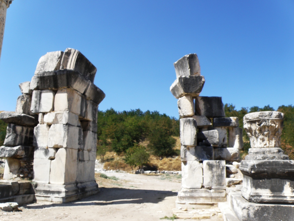
Intricately carved posts--must have been entryway
for a street leading to something or someone important.


Gate to Boulerion (not to temple area as originally thought)


Out in an open field stood a 'gate' -- which means carved stones placed to resemble a doorway opening.   It was first thought that this gate was the entrance to the penbolus or precinct surrounding the temple, an enclosure over 100 yards square, of which very little else has been located to date.   We saw no evidence of digging in that general direction.  Farther past that area is the temple.  The Serapeum, or a temple dedicated to the cult of Serapis, was built around 200 A.D. and is full of inscriptions and invocations to the gods.  This period was right on the cusp of the Romans' conversion to Christianity.  The location of the very much older temple of Zeus Chrysaoreus is known to be on the site somewhere but its locations remains unknown. 


The Boulerion
Today, after further excavation, it has been confirmed that this lone gate did not lead to the area surrounding the temple.  This gate was the entry to the Bouleuterion (assembly meeting place).  On the northern external wall of the Bouleuterion, the price list of Diocletianus and the introduction part relating to the application of it are engraved in Latin.  Diocletianus was a Roman emperor  who attempted to control inflation via price controls and he ordered a list to be published setting the maximum prices of many items.  Diocletianus and his price control attempt  


Pomegranates and figs grew
by the thousands all over the
site.  Continual growth since
antiquity?


That must have been one huge
column!  Waist high diameter.
Relatively close to the old temple is the theater.  This theater seated 15,000 people.  We did not walk out to see this temple.  I think all 4 of us have seen enough Roman temples.


Wandering ancient walkways


We're the Fugari. (Sound it out)


We also did not linger at the Roman baths.  Nor the Turkish baths.  Although the very first thing one encounters upon entry to this site from the parking area are the Turkish baths.  Right next to the current mosque.  Very close to the current little 'village square' and across from the 'village coffee shop' that was recently restored by the Young Men's Business League in the nearby city of Yatagan.  We did stop there for drinks and snacks before departing.


The colonaded street.

We wound around through rock walls and paths and eventually found the colonnaded street and monuments.  Randal wanted to see some mosaics that were in this area.  
Plastic covered mosaics

Unfortunately, most of the mosaic areas were covered by plastic sheeting for protection from the elements.  The archaeologists had placed barrier tapes to discourage visitors from disturbing the mosaic areas.  So we didn't really get to see much of the mosaics.


Overlooking towards valley.  The Necropolis was located
down that way.  Someday will be a lake.

The view down to the valley was breathtaking.  This must have been a beautiful place.

The road outside the city wall leading up to the Northern City Gate was called the Holy Road.  It also led down to the city's Necropolis.  The Necropolis is gone today, destroyed in recent years by coal mining for the nearby Yatagan Power Plant.  When all the coal has been depleted, the low-lying areas will be submerged when a man-made lake is created.  That will really nice for this area --a large mountain lake.


The North Gate as it stands today


At the end of the colonnaded street stood the northern City Gate and Fountain. 


The fountain pool.  Floor is covered in mosaics.

Clay water pipes visible in many places.  These led to
the fountain pool beside the North Gate.
The pamphlet illustrates an image of what this would have looked like during the city's heyday.  The reality today is somewhat different.  But your mind's eye can envision what this must have looked like.


The North Gate as it looked during ancient times (per the tourist brochure).  Wouldn't it be great to see this
fully reconstructed.

Mosaic pattern in floor of fountain pool.
Long before German Nazis.  We have seen this same
symbol used by Kuna natives in Panama and on a couple
of South Pacific islands.  Wonder how this symbol
became used worldwide before global travel was possible.

Mosaic pattern in floor of pool.
Tridents.


Mosaic pattern in floor of pool.
Pomegranates.


Outside mosque entry, below ground level.  This looked like water would
flow through.  Appeared a perfect place for early Christian baptisms,
although nothing in our tourist literature mentions Christians ever
inhabiting this area.  

When I researched Stratonikeia (after we visited), I was shocked to learn about its Christian history.  According to Wikipedia, Stratonikeia was Christianized early.  It was a Titular See.  The Notitae Episcopatuum mention the See up to the 13th century among the suffragans of Stauropolis.  Only 3 of its bishops are known, by their signatures at councils:  Eupeithus, at the Council of Chalcedon in 451 A.D.; Theopemptus at the Council of Constantinople in 692 A.D.; and Gregory at the Council of Nicaea in 787 A.D.  

(Now, THIS is what shocked me.)  

Stratonikeia remains a Titular See of the Roman Catholic Church, Latinized as Stratonicensis in Caria.  The Seat has been vacant since the death of the last bishop in 1977.

In a secular country that is 99% Muslim.  And in a village inhabited with only 5 families, all of whom are Muslim.  Think it might be time for the Catholic Church to update their records?

Village Coffee Shop restored by the Young Businessmen
in nearby larger city of Yatagan.


Ruth was hungry and the rest of us were hot and thirsty by the time we finished exploring the North Gate area and trekking the long way back to the entrance.  So we stopped in the village coffee shop/cafe to see what could be purchased in the way of libation and nourishment. 
Randal and Bill


Ruth waiting for her Tost


Ruth ordered a Tost; I gulped down 2 bottles of water; and Bill and Randal enjoyed cold beer.  (Tost is a popular sandwich, found literally everywhere in Turkey.  Usually has a slice of cheese, a slice or 2 of tomato, and maybe a slice or 2 of some kind of beef deli meat.  Placed between 2 slices of bread and placed on a grill with a weight on top to squish it down.  No butter or oil; cooked dry.  This is pronounced just like our normal toast.)
We shared the coffee shop with one of the local chickens.