TRANSLATE, TRADUIRE, ÜBERSETZEN, TRADUCIR, 翻译

Friday, May 25, 2012

Touristy things -- Demre, Myra and Ucagiz


Guess what these are.  Hint: they are 2,000 years old.  We've had fun exploring!

Kas Marina from hilltop
After a couple of nights in the Polemus anchorage at Kekova Roads we motored farther west to Kas Marina last Saturday.  Sunday afternoon our friends Chay, Katie and Jamie on S/V ESPRIT arrived.  We first met them sailing toward Cairns in Australia in 2009, and later reconnected for Christmas Day in Phuket 2010; then Sri Lanka, Cochin and Maldives in early 2011.  ESPRIT transported on the BBC Everest with the rest of us through the Somali pirates to Marmaris.  
Kas old harbor (no yachts allowed)
Greek island Kastellorizon
in background.  Close, huh?
They left ESPRIT in Marmaris and flew home to Las Vegas for a year. They returned and began cruising south/east along the coast of Turkey a month ago.......as we are sailing (motoring) north/west.  We had hoped to eventually meet up.  Kas turned out to be the meeting point.  My how Jamie has grown!  At 15 he is taller than both mother and father and so much more mature than the 11-yr-old little boy we first met in Australia.  Chay and Katie rented a car and asked if we would like to join them for a bit of land tourist sight-seeing for a couple of days.  Sure!!


Saint Nicholas statue
Remember Demre (Kale)was mentioned in a recent posting as the hometown of Santa Claus.  Or at least the place where Saint Nicholas lived and became known for his generosity.  Katie informed us that St. Nick was not born in Demre (Kale); he was born in Patara....which we would visit on Tuesday.  On Monday our first stop was the Church of St. Nicholas, the Noel Baba, in Demre, the town where Saint Nicholas lived most of his life.  Remember, Saint Nicholas also is considered the patron saint of pawn brokers and sailors.....that odd combo.


According to the entrance brochure Saint Nicholas was the Bishop of Myra.  He was born during the second half of the third century A.D. and canonized after his death (well, duh!  When was the last time someone was canonized as a saint while he or she was still alive).   Or he was born at the turn of the fourth century; the literature we read gives both estimates.   He became the most popular saint in many European countries, especially old Russia.  He became known as Santa Claus among Dutch and English speaking peoples.   Centuries later he won the affection of Americans and became regarded as one of the saints protecting New York (thanks to all the Dutch settlers in that region).  The North European tradition of Santa Claus, the protector of children who made them happy, and the belief in Saint Nicholas led to the creation of a semi-religious and very popular legendary character.  The large sleigh of Santa Claus pulled by reindeer indicates that this character originates from the ancient beliefs of northern countries.  The real Saint Nicholas of Myra lived on the shores of the Mediterranean Sea where it never snows.  From a person who protects children in need, he was converted into a sympathetic old man believed to bring Christmas gifts.  


One of many frescoes inside Noel Baba
The bare earthen Church of St. Nicholas features Byzantine frescoes and mosaic floors.  The first mention of the church that I found was when Saint Nicholas' remains were interred here upon his death in 343 A.D.   The church in Demre was destroyed in the 8th century by earthquakes and attacks to the city.  In the 9th century it was rebuilt as a domed church.  Later additions were made in the 11th century.  The most important restoration was ordered by Zoe, wife of Emperor Constantine IX, in 1042.  Most of the wall frescoes and floor mosaics date from this period.  The church was made a basilica after this restoration.  Italian merchants smashed open the sarcophagus in 1087 and supposedly carted off the bones of Saint Nicholas to Bari, Italy, where they remain today.  


UGLY bracing attempting to preserve church
Restorations sponsored by Tsar Alexander II of Russia in 1862 changed the church by building a vaulted ceiling as the middle dome and a belfry -- something unheard of in early Byzantine architecture.  (Various sources indicate that it was Tsar Nicholas I who sponsored this restoration, but he was not the Tsar of Russia in 1862; it was Alexander II.)  Thus, the church looks like a complex built in various periods.  More recent work by Turkish archaeologists is to protect it from further deterioration; although all that metal scaffolding holding stones together is most unattractive.  Hopefully the metal bracing will be removed once the preservation methods being employed are completed.


Interior Church of Saint Nicholas


I won't go into all the details about the complex regarding narthexes, naos, bema, apses and synthronon because the only person who might find these of interest would be Bill's brother who is a Catholic priest and knowledgeable about church construction........other than to mention the outer narthex was rebuilt during the restoration in 1862, whereas the inner narthex maintains its original design.  Per the brochure:  "The oldest wall frescoes depicting the prophet and ecumenical councils are on the vaults of the inner narthex."  Since this is predominately a Muslim country, I assume that 'the prophet' refers to Jesus.  Islam does recognize Jesus as a prophet.


Wrong sarcophagus
At one point inside the church Bill and I got caught between 2 large groups of Russian tourists in a wide corridor.  We had no idea why everyone was congregated there or why the mass of people were moving so slowly.  
The actual sarcophogus
Bill wiggled ahead of me and held the camera high over the heads of people; snapped a photo of the area they all appeared to be centering on; and we sneaked out through a break in the wall.  Much later when I looked at the photo, I realized that the Russians thought they were standing in the line to see the sarcophagus of Saint Nicholas.  They were wrong.  There was a fancy sarcophagus in a corner at the end of that corridor that had a carving of a man on top of it.  But the brochure stated that the bones of Saint Nicholas had been stolen from the sarcophagus located in the far western area of the church.  That was in a totally different corridor.  But I guess the religious Russians were happy standing in that line and touching the fancy sarcophagus because they didn't know any better.


Russian religious tourist
Respectful religious Russians
Almost all visitors to this church today are Russian.  The women and girls still cover their heads with scarves when entering the church, like the Roman Catholics did prior to Vatican II.   It was odd to see young girls wearing tight short-shorts and tee-shirts or short skirts with high heels but with their hair covered by long scarves.  Guess bare skin doesn't count as disrespectful inside a church as long as the hair is covered.  


More Russian tourists inside church

Nicholas is the patron saint of Russia.  We got a kick out of the fact that the museum gift shop and all nearby souvenir shops price the merchandise in US dollars.  This is very unusual; everything is normally priced in either Turkish Lira or Euros.  US dollars normally are not used in this part of the world.  Except by the Russians.  The Russians still love US dollars and prefer our currency over Euros.  One of the few countries left in the world that likes US dollars. 


Lycian rock tombs at Myra
Next we drove a short distance to Myra, specifically the Myra Archaeological Site.  Little is known about this ancient Lycian city.   The date Myra was established is uncertain, but an outer defense wall dates to the 5th century B.C.   It was the capital of Lycia and for a long time was the most important city in Asia Minor. Just think; most people today have never heard of Myra.  Someday New York City could be just as forgotten.  At one time Myra was situated right by the sea, but alluvium deposited by the Demre river (Andraki Nehri) has built up a coastal plain for several miles around, as well as covering much of the ancient city about 10 feet deep.  We drove several miles inland from the sea today to reach Myra.  It is hard to fathom how much this area has filled in with dirt over the past 2,000 years.  


One of many carvings
In Roman times the emperor Germanicus and his wife Agrippina paid Myra a visit in 18 A.D.   As was the custom of the time, these important visitors were honored with statues of themselves erected in Myra's harbor (Andraki).  We did not seek out these statues.


Such detailed carvings at this old theater!
At the beginning of the Christian era, Saint Paul was bought here from Jerusalem about 60 A.D. as a prisoner on his way to his trial in Rome.  The port of Andriaki (Andriace) was adjacent to Myra and was a major trans-shipment port for grain.  Egypt was the bread basket for the Roman Empire.  Grain was brought from Alexandria to Andriaki.  The plains around Myra also were a major source of grain.  The grains from Alexandria and Myra were combined onto grain ships which then sailed to Rome.   The grain ships also often transported passengers.  Paul was put on a grain ship that went south around Crete and later wrecked on Malta.   As we all know, he did eventually make it to Rome, where he was executed.  Myra was also visited by Luke and Aristharchus (Acts 27:5/6 per the sign at Myra), who was Paul's fellow prisoner in Rome.


Bill inside theater; rock tombs upper right.
We know that Myra was a major source of rue at that time.  Rue was (and still is) a hardy perennial herb that grows in a bushy rounded manner.  It is common in SE Europe and is closely related to the orange.  In olden times it was highly reputed for seasoning and for medicine among the Greeks and the Romans.  Today it is seldom used for seasoning, although sometimes used by Italians and Germans but almost not at all by English and Americans.  It has a bitter taste, which some people develop a taste for both in foods and beverages.   It has a very pungent smell.  Probably because of its acridity and its ability to blister the skin when handled, rue has been chosen by poets through the centuries to express disdain.  Shakespeare speaks of it as the "sour herb of grace."  I had never heard of rue until I started researching the history of Myra.  During the Greek and Roman times, rue was used for 74 medicinal applications.  Wonder for what ailments.


Emperor Hadrian visited Myra in 131 A.D. and built a huge granary at Andraki composed of seven rooms and decorated with portraits of himself and his wife, who accompanied him on this visit.  This granary is still visible as one drives along the main highway into the western side of Demre (from Kas).  But if you don't know what you are looking at then it just looks like another stack of old rocks.


Fortress at top; rock tombs spaced about the mountainside;
two-tier theater with double vaulted corridor/stairs on left;
stage behind the arched openings at bottom;
note where people are standing at right shows how deep it was silted in.
Myra once had a great temple of the goddess Artemis Eleuthera which supposedly was Lycia's largest and most splendid building.  It was built on large grounds with beautiful gardens and had an inner court defined by columns, an altar and a statue of the goddess.  Not a trace of it remains today.  Saint Nicholas, in his zeal to stamp out paganism in the region, had the temple of Artemis, along with many other temples in the region, completely destroyed.   Awww, Santa Claus, you really should not have done that!


Lycian rock tombs at Myra


Myra lost one-third of its population during a terrible plague that swept through Anatolia in 542-43 A.D.  (This region is part of the large area known as Anatolia.) The city fell to the caliph Harun ar-Rashid in 808 A.D. after a siege; and Myra quickly went into decline.  Around 1100 A.D. Myra was overtaken by Seljuk invaders.  Because of Muslim raids, flooding and earthquakes, Myra was mostly abandoned by the 11th century.

At Myra there are numerous well-preserved Lycian rock tombs.  Until recently tourists could actually climb up to the tombs and examine these at close quarters.  Today the tombs are marked off with a barrier of yellow tape to keep visitors from climbing into the tombs.  This did not prevent some of the younger tourists from going around the yellow tape barrier and having their photo taken standing in the tomb entryways.  There were no security guards to prevent this activity and the archaeologists were busy with their digging and did not stop to prevent the tourists from going where they should not.  


The grassy areas in front show how deep it was buried
These rock tombs are considered the best preserved Lycian tombs anywhere.  Of course, the tombs have all been robbed.  Most that have been unearthed or discovered are close together on the left side of the Roman theater.  But we could see other tombs scattered about on the mountainside.  Those were too high to access.  Made me wonder how the people built those tombs so high up with sheer drops down the mountain.  


There supposedly is something called the Painted Tomb near the river necropolis at Myra.  It supposedly portrays a man and his family in stone relief both inside and out of the tomb.  I say 'supposedly' because we did not find this particular tomb.  High above the archaeological site sits a fortress (Roman?) but we did not see a way to get up there.


Myra is an active dig
The Myra site is still an active archaeological dig.  The day we visited men were excavating stones in the area behind the stage for the theater.  There were fields of numbered stones of every imaginable size and shape adjacent to the theater and tombs.  
Archaeologist still working behind theater stage area


I would love to see into the future and know what they will discover and re-construct in the next 50 years.   We know so little about the Lycians and their culture.  (More about ancient Lycia in my next posting.)


Bill at Myra; note fortress far upper right;
many rock tombs in mountainside; inside theater.
The theater at Myra is in pretty good condition but there is so much more to be excavated and reassembled.   The theater has 38 rows of seats, 29 lower and 7 higher rows with a wide walkway separation.  One source states that the theater was Greek in origin; another gives credit to the Romans.  I assume it is like most of the theaters in the Eastern Mediterranean and was originally built by the Greeks and then later modified by the Romans.   The theater was destroyed in an earthquake that devastated the city in 141 A.D., but  was fully restored quickly thereafter.  Shortly after that restoration, the theater was modified so that it could be used as an arena for gladiatorial games.  Our photos show how high the first row of seating was from the modified floor area to protect spectators from participants of these popular violent spectacles.  


Double vaulted corridor to upper rows of seats
This theater was more complete than others we have seen elsewhere.  Double-vaulted corridors were on either side.  On the left inside the double-vaulted corridors were steps leading up to the top rows of seating; all very well preserved...with tourists walking up and down today.   The facade was richly decorated with theatrical masks and mythological scenes; many of which have been excavated but not yet placed back in their original positions. I found some of these remarkable.


Face carved on a corner.  I love this guy.


One in particular caught my eye.  It was different from anything we have seen elsewhere.  There was a face carved on the very corner.  Quite striking.  Wish there had been more information available about this particular stone; such as where it might have been displayed and what the meaning might have been.


Jamie imitating the corner face carving

Many, many face carvings all around the site
There is an inscription in one of the stall spaces that reads in Latin "place of the vendor Gelasius."  This would be the location of an ancient concessions stand at the theater.  Cool.
Carvings not just of faces


Rock tomb out in the middle of a field, all by itself.


After Myra we stopped back in Demre for lunch.  Then drove back towards Kas.  
Isolated Lycian rock tomb
There was plenty of daylight left so when we saw the sign to turn to Üçağız the decision was unanimous that we must go there.  As we drove down off a very narrow poorly maintained mountainous road onto a flatter road through a plain toward our destination, one of us looked out at a field and noticed another rock tomb.  Just out there all by its lonesome.  (That is probably a Texas expression that won't translate for most people.)  


How cool was that!  We happened across an isolated rock tomb way off the beaten path.  As we drove through the area we noticed several more individual tombs, but not a cluster as in Myra.


Üçağız is pronounced EWCH-ah-uhz (try saying that 3 times fast) and translates as 'three mouths' for the three rivers that empty here into the Mediterranean Sea.  The ancient city situated here was called Teimiussa.  There are more Lycian tombs over 2,000 years old and even a Lycian necropolis.  And a sunken Roman city just beneath the surface of the water, which is accessible only via a boat tour.  None of us felt like doing a boat tour so missed out on seeing the sunken Roman city.  Ditto for getting out to see the castle that is really a Roman fortress on the hilltop on the peninsula.  There are no roads or walking paths to get out there.  We saw the fortress last week from our boat, but did not feel comfortable taking our boat into that tiny reef-strewn bay crowded with all the tourist boats.  And we did not want to go on a tourist boat today either, so that fortress will be skipped.  You can see it from land or sea; you just can't get there unless you take a tour boat.

I am glad we drove down to see  Üçağız.  It was a charming little village.  The government wisely prohibits any new building construction here.  Wish we had waited to have lunch there instead of eating in Demre.  This little village deserved further exploration, more than the quick drive through that we did.  Instead, we stopped at a tiny produce market where I bought peaches, cherries, melon, green beans and other things that had not been in the supermarket in Kas.  First time we have purchased fruits and vegetables at actual local prices.  Amazing how much produce 6 bucks will buy at a local Turkish village market.   

Old Teimiussa is well off the beaten path.   And it is well worth the trip.

Conversion errors

Something is beginning to annoy me and I'm not sure there is anything we can do about it.  Our boat was manufactured in France and all measurements are metric.  The literature and architectural drawings from our boat manufacturer, Amel, all state that BeBe is 16 meters LOA.  That converts to 52 feet 6 inches, or 52.493438320209975 to be exact.   All the metric measurements had to be converted when we applied for US Documentation.  Either the National Vessel Documentation Center rounded up when they calculated the conversion for our documentation or the documentation agent we used made an error because our US Certificate of Documentation states 53.0 feet LOA.   And the correct beam width is 4.6 meters; but the Certificate of Documentation states 15.3 feet which is 4.66 meters.  The correct figure should be 15.1 feet.  That 6-inch error in length and the .2 feet error in beam width are costing us every time we dock in a marina in the Med. 


In most of the Med the berthing or docking charge is determined by the square meter size of the vessel:  length times width.  In our case, the correct calculation should be 16 X 4.6 = 73.6 square meters.   Because of Certificate of Documentation states 53 feet LOA rather than the correct 52.5 feet and 15.3 feet width rather than the correct 15.1 feet, each marina calculates our LOA as 16.15 meters and the width as 4.66 meters.  16.15 X 4.66 = 75.2 square meters.  That is an error of 1.6 square meters.  


Doesn't sound like a big deal, right?  And it really isn't.  It just annoys me.  Here in Kas Marina that means a difference of 1.1 Euro overcharge per day ----- roughly $1.43 USD overcharge per day.


Due to conversion calculations from metric to feet and back to metric.  


Life would be easier if the United States joined the rest of the world and converted to metric.


Sunday, May 20, 2012

Someone....anyone....please talk us out of doing this!

We are leaning more and more towards wintering next season in the new marina being built in Istanbul.  Our friends and readers of this blog know what wimps we are about cold weather.  It snows in Istanbul!!  Have we totally lost our minds?!?!


We have obtained quotes from 11 marinas and have shortened the list to a possible 5.  Returning to Karpaz in Cyprus or the new marina in Istanbul (should be ready for occupancy in August or September 2012) are equally at the top of that list.  The other 3 marinas are better situated geographically for beginning the cruising season in May 2013 but have no other positive qualities in our opinions.  We really liked Karpaz and the winters are milder (still very cold to us!); but we have already seen everything of any interest to see on Cyprus.  Istanbul is COLD but would make international travel very easy and the city is great in itself; lots of things to see and do.  We will return to Houston for at least the month of December anyway, leaving only January and February/March to contend with the coldest weather.


What to do?  What to do?


Update 23 May 2012:  We have now been talked out of wintering in Istanbul.  A Turkish friend emailed us recent photos of the Marina Istanbul under construction.  Based on these photos we would be shocked, extremely shocked, if this marina is actually ready for occupancy by September 2012.  We absolutely would not chance this.  Sailing to Istanbul is "uphill" all the way......meaning against the wind and against some very significant currents.  And the older marinas in the Istanbul area already are filled to capacity.  It would be terrible to fight our way all the way to the new marina and find it not ready to accept boats for winter berthing.  Where would we go then!  So Marina Istanbul is no longer under consideration as a place for berthing next winter.


Thursday, May 17, 2012

Santa Claus' home town


Looking out from Cineviz Limani anchorage


Up at 04:30 Sunday morning so we could depart Alanya Marina at 05:00.  The sail (mostly motoring) westward across the very large bay to the next anchorage would be 73 NM and we wanted to arrive in good daylight; hence the early morning departure.  Sure enough, we motored 9 hours in only 1 knot winds.  


The mast on that white boat is 65-ft tall.  Kind of gives
perspective on how high that cliff really is.


But the final 3 hours as we approached the high mountains on the westward coast the winds picked up and ranged 15-20 at 57 degrees off the port bow. Lovely sailing conditions!  What a treat.  And we even were able to run the watermaker for 2 hours and put 400 liters of good tasting water into the tank.  The marina water was unacceptable in Alanya for drinking (tested 680 TDS!!!).  We had been forced to buy drinking water, and we are very glad to go back to drinking the water we make aboard BeBe.  It tastes better than any of the drinking water purchased.

Tiny splashes of pink flowers were all up
the mountainsides growing in rock
Tiny ruins, high mountain

The entrance to Cineviz Limani is difficult to spot.   You do not see the narrow bay entrance along the high mountains and sheer cliffs until you are practically on top of it.  Entering is straightforward.  There were 3 sailboats already anchored near the beach, as well as 4 tiny fishing boats.  But there was ample room for us to nestle into the small anchorage.  


Small anchorage at beach at Cineviz


We dropped anchor at 36.21.916N  030.30.028E.  Cineviz Limani is a gorgeous anchorage and very well protected.  The depths drop quickly from 8 meters to 30 meters, so there is room from only about 5 yachts to anchor unless everyone ties stern to shore.  With only 4 boats, none of us were forced to tie off.   I hate bothering with that.


Thread through the rocks to Gokkaya Limani anchorange
The next day was easy motoring 39 NM to Gokkaya Limani.  We dropped anchor at 36.12.64N  029.53.622E.  This is another gorgeous anchorage.  Extremely well protected from every direction; in a small bay behind several small islands.  Gulets come and go all day long.  As this is  very early in tourist season, most of the gulets had a minimal number of customers.   
Gokkaya Limani

One gulet anchored overnight near us that had only 3 young women aboard as paying guests.  We could hear the girls yelling to one another as they swam nearby and could tell they were Americans by the distinctive accents.

Tiny ruins at Gokkaya Limani near small river
We stayed in Gokkaya Limani for 3 nights.  Put the dinghy into the water and very briefly explored the beginning area of the small river (creek, IMHO) at the head of the small bay.  There are ruins situated low on the hillside adjacent to the small river.  We were not wearing shoes and I had not applied insect repellent, so we did not climb around in those ruins.  Did not look particularly interesting anyway.  Off our bow we could see Andraki, and it was close enough for access by a long dinghy ride.  Andraki is the ancient Lycian city previously known as Myra.  The Demre River has long since silted up and built a coastal plain for several miles around and has covered much of the old city of Myra.  According to our guide book little is known about ancient Myra, but at the beginning of the Christian era Saint Paul was brought here as a prisoner on his way to Rome and his death.  Paul (Saul) was put on a grain ship that went south around Crete and was later wrecked on Malta.  At Andraki there are numerous Lycian rock tombs and a well-preserved Roman theater.  We have seen enough old Roman theaters.  Bill was not interested in visiting another.  Being the frugal person that I am, I did not see any point in wasting expensive gasoline for a long dinghy ride just to see more old rocks.  The guide book photos were not that appealing; we've seen better and know there are better ruins to see elsewhere later in Turkey.


Andraki does have some interest.  In the village of Kale (known today as Demre) is a church dedicated to Saint Nicholas.  Nicholas is the patron saint of the sailor and the pawnbroker -- an odd combo.  He is better known as the original Santa Claus.  Many stores are told of the good Bishop of Demre, and it appears that he was indeed a generous man who extended charity to the poor of his town.  Per our guidebook:  "One story relates how he donated a bag of gold to a poor family.  Wishing to remain anonymous, he climbed up on the roof and dropped the bag down the chimney.  The daughters of the family were drying their stockings in front of the fire, and the gold fell neatly into one of them.  A harmless enough tale to bestow legitimacy on the tradition of putting stockings out for gifts for Christmas."

Nicholas was martyred here in 655 and his grave soon became an important place of pilgrimage.  His bones were stolen by merchants from Bari Italy in 1072 and transported to a church located there.  His remains still lie in Bari today.  The small church here in Kale which is dedicated to Nicholas has been partially restored with funds from the Greek Orthodox church.  However, recent construction now surrounds and dwarfs this tiny old church.  According to our guide book, the church still retained atmosphere only a decade past.  Today it is surrounded by plastic Father Christmases.  The Noel Baba festival, honoring the saint of that name, is held here in early December each year.

Ruins at Castle Bay in Kerkova Roads
Today we motored from hidden Gokkaya around numerous small islands and westward through the area known as Kerkova Roads.  A whopping distance of 6.4 NM.  We could get really spoiled by this leisurely pace!  Short day hops suit us just fine.  
Watch out for these!

Along the way we passed numerous tourist day boats and gulets.  
And watch out for these!

This is a very popular tourist area.  Several small groups were out kayaking.  It is not always easy to see those low-profile kayaks when winds are blowing up choppy seas.  I think these groups should be accompanied by a boat to protect them from being run over by all the sailboats and tourist day boats.

Castle near Kale Koy


We opted not to go into Ucagiz Limani.  It appeared that there are only 2 reasons for threading your way through the rocks to get into this large bay -- to visit restaurants or to walk the ruins of ancient Teimiussa.  We gave both those activities a miss.


It really is a Crusader Fortress, not a real castle.


Near the center of Kerkova Roads there are ruins of a conspicuous castle on the hilltop near Kale Koy.  The guide book does not provide much information about this castle.....not even the name or date of construction.   To the east of the hilltop castle is a small bay called Castle Bay where there are numerous ruins.  No information about these is provided.


Homes built among the sarcophagi near castle


Near the large hilltop castle ruins are numerous sarcophagi.  Some have toppled over, but many still stand erect on their pedestals -- where they were placed two or three thousand years ago.  Looking down from the castle provides a good view of parts of the sunken city that is believed to be ancient Simena.  A single sarcophagus still stands half submerged on the western side of the bay.  Today's restaurants are built upon the old sunken quay.


Looking eastward down Kerkova Roads from Polemos Buku


We motored to the farthest western point of Kerkova Roads (Polemos Buku anchorage) and dropped anchor at 36.09.902N  029.48.199E in front of the only building -- a small restaurant.  The restaurant has short docks with space for 4 boats.  We are not interested in eating in a restaurant and actually prefer to be anchored out away from shore.  Breeze is always better out at anchor and usually less bothersome insects.  


Looking westward at Polemos Buku at the restaurant


Plan to stay a couple of nights and then probably move on to Kas.


Fellow Texans.  From College Station.  How about that!


Shortly after I posted this blog entry, a couple of kayaks paddled by.  They went up to the restaurant for a couple of hours, swam off the rock beach, and then climbed back into the kayaks to head back to the resort rental place.  As they passed our boat one couple spoke to Bill -- because they saw our Texas flag flying beneath the port spreader.  Turns out they are from College Station, Texas.......home of Texas A & M University.  Gig'em! 

Bill offered them a rest aboard S/V BeBe but they declined because they must get back to that resort to return the kayaks by a specific time today.  Small world.  How odd to run into fellow Texans in this very remote anchorage in Turkey (and even from the same university that Bill attended).
Their friends.  Not from Texas.

Saturday, May 12, 2012

Alanya, ancient Anemurium and Mamure Castle


Ancient Anemurium from 1/2 mile at sea
Anemurium--side of basilica
The 66.8 NM passage from Bozyazi harbor to Alanya Marina was yet again done motoring.  I swear there is no such thing as sailing in the Med.  We were able to motor-sail about 2 hours, but that was it.  The rest of the way was 8 hours of pure motoring.  Marina staff directed us to a berth.  
 (As always, click on any image for larger view.)
Directly at our stern across the dock was S/V Hamamas.  We last met Fran and Tom at Rebak Marina in Malaysia.  Yet again an illustration of the smallness of our world.  They wintered here at Alanya Marina.  Our reunion was very short-lived because early the next day they departed for a 3-week sight-seeing trip around Turkey.  We arranged a rental car for the next day.  We did not come here for the amenities of a marina; we came here so we could back-track 50 miles in a car to see the ancient sites that were visible from our sailboat but inaccessible from the water. 


Mamure Castle as seen from our boat
That 50 miles as the crow flies turned into 98 miles each way......winding road up the mountains, down the mountains and around the mountains.  The road was narrow with barely sufficient width to pass the oncoming trucks in many places.  Bill was forced to screech to a halt many times as large trucks came around tight curves straddling the middle line, especially on the outside tight curves high in the mountains.  


Mamure Castle from sea
This is the main highway to get to Mersin, a large port down near the Turkey/Syria border, so lots of goods are transported by truck via this road.  Construction was underway in 3 areas to enlarge the road and straighten it out to avoid some of the tight curves.  


Dusty mountain road construction
Driving behind the trucks was very dusty.  We passed 3 sets of tunnels that were already completed but connecting roads were still under construction.  At one point we passed a car that was upside down in the road.  We could not figure out where this car fell from.  There did not appear to be any roads higher up and there were no impact marks on the front or rear of this car.  It was simply upside down with the roof caved in.  I would be very surprised if the driver survived.  There was an ambulance already on hand and no one appeared to be rushing to extricate the occupant(s) of the wrecked car.  Sad.


Marble quarry
At one place alongside the road there was a large marble quarry.  I had no idea that the marble was formed in straight sheets in the ground.  I always thought the marble was removed in large blocks and then cut into straight sheets.  


Small 2000 yr old homes on hillside at Anemurium
After over 3 hours driving from Alanya we finally arrived at our first destination -- the ancient ruins of Anemurium.  As our guide book states:  "The extent of the ruins and the completeness of parts of the old city give the impression of a ghost town."  We had seen Anemurium when we motored past the previous day.  Even over a half-mile offshore these ruins were impressive.  Even from way out there it looked like a stone ghost town.


Note random large stones turned vertically.  This
greatly increased stability of the thick walls.
Anemurium was occupied by various peoples from the 12th century B.C. through the 7th century A.D.  Hanoii celebrated its anniversary of 1,000 years in October 2011.  Anemurium was continually inhabited for about 2,000 years.  Yet hardly anyone has ever heard of  Anemurium.  It was almost eerie walking around and inside the old stone buildings.  It would have been nice to have had a guide to make the stones tell us their stories; but there are no guides for this site, just a ticket booth.  And the attendant stays in a house nearby rather than manning the ticket booth.  


The only other visitors
I think visitors are rare for this site because it is well off the beaten tourist path.  We were the only people there........and a herd of goats with their dog, of course.  Can't go anywhere without encountering a herd of goats or sheep and their herding dog.


Small home. Niches on each side of doorway would
have held statues of gods during Roman times.
Most of the surviving buildings date from Roman times with some later Byzantine additions.  The city is supposed to have been founded by the Phoenicians in the 12th century B.C. and construction heavily reinforced by them in the 4th century B.C., although it was later occupied by the Assyrians and Hittites.   It was regained by the Phoenicians and it is easy to see why this place was important to these maritime traders.  Anemurium sits as close to Cyprus as you can get on the coast of Asia Minor.  The name means 'the windy cape.'  The old trading ships coming from or going to Cyprus would have valued the shelter here.  Today yachts are advised not to anchor overnight here because of swell making the anchorage too rolly.  You can anchor here during the day only.  (But then where do you go?  There is nowhere nearby to anchor overnight.  So unless you plan on sailing overnight, don't stop here in a boat.)  


Odeon--all was covered in marble back then
Cistern (complete) at Anemurium

After the Phoenicians Anemurium was occupied by a vicious Cilician tribe in 52 A.D.  Later, this area came under Greek control; then later under Roman control like most of the Mediterranean countries.
Note water circle where water pipe
exited cistern


Entrance to Odeon--seated 900 persons


The ruins consist of a few large buildings like the odeon (theater) which seated 900 persons (men, of course; remember, no women allowed in the theaters), and the 2 baths, the nymphaeum, the aqueduct, and a large building right at the water's edge (which looked like a place that might administrate the harbor shipping activities to us).  


Odeon--mosaic floor stage
Then there were many, many tiny stone houses built up the hillside.  The ruins of these small buildings continued far through the brush and small trees.  And one must assume that outside these stone homes would have been the wooden homes of the poorer people, which obviously have long since rotted away.


There were 2 long sections of the aqueduct visible.  We did not climb up there to investigate closer because there were flying insects and we did not want to walk in the high grasses.


Aqueduct upper right; fortress walls high on hill.
On the very point of the cape stands the remains of a very large fortress or citadel.  The walls are very evident.  This would have been a place of refuge for the town's inhabitants during attacks.
With a crown of flowers someone left


Pointing to fallen column top and base down by sea
Checking out fallen marble from the old buildings

Anemurium reached its heyday in the 1st to 3rd century A.D.  Mosaics dating from this period can be seen in one of the bath houses and the odeon and the basilica.  Mosaics are also visible in the floor of the 'harbor' building by the shore.  The churches dotting the site were built by the Byzantines.  There seems to have been something of an industry here producing mosaics and glassware.  


Marble pieces from buildings fallen down to sea


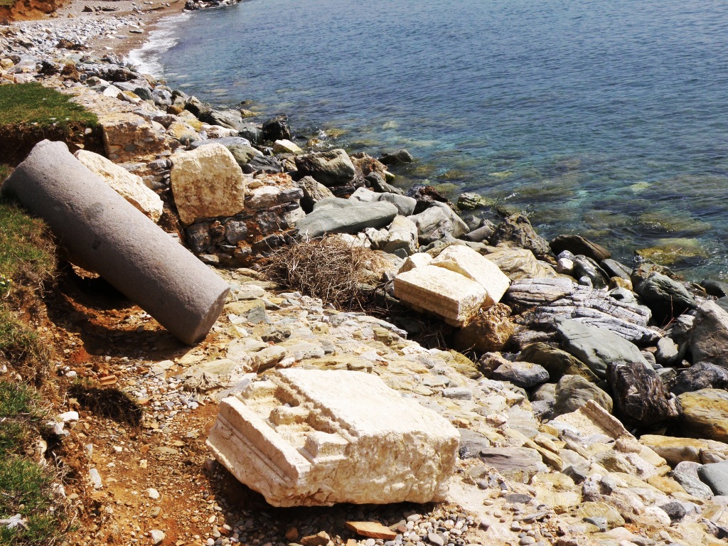
In 580 A.D. a large earthquake damaged the aqueduct and many buildings.  Toppled marble columns are still seen lying in the sand on the beach.  Amazing that these are still visible and not covered by the sands of time (or rising waters of global warming).  There were many bases and tops for these columns found lying among the tumbled boulders down to the seaside.  Bill managed to work his way down the stones to closely examine a few.  (Thank goodness he did not fall and break a bone doing this because there was no one to help get him back up from there.)  We could see large sections of marble that obviously had decorated the roof line of buildings all those centuries ago.


Marble columns fallen down to the sea
Marble fallen into the sea
This site was amazing.  And we could only imagine what it must have looked like during the Roman times when every surface would have been covered in marble.  We feel fortunate to have been able to visit.


Marble column at Anemurium


This earthquake did not cause the city to be abandoned.  The Arab pirates did that.  Anemurium was periodically utilized to protect the coast, but not fully inhabited as it had been earlier.  Around the 12th century A.D. the nearby Anamur Kalesi (Mamure Castle) was built about we miles eastward on the far side of the bay.  The Anemurium site was effectively abandoned for good, ending 2,000 years of habitation.


And Mamure Castle was our next destination.  This castle is considered very romantic.  It is by far the largest castle found anywhere along the Turkish coastline.  There are crenallated walls surrounding the entire castle.  It has 39 towers.  Part of the original moat is still intact.


Inside western courtyard Mamure Castle
Anamur Kalesi was built by the Kings of Lesser Armenia in the 12th century A.D. on the site of an earlier Roman fortress dating to the 3rd century A.D..  It really is a big place.  


Entrance Mamure Castle

Mamure was taken by Karamanoglu Mehmet Bey and his troops in 1308 A.D. and alterations began., including the addition of a mosque within the castle walls in the eastern courtyard.


Moat still in place.
In 1840 the castle was restored by the Ottomans.  The Ottomans used it right up until the early 20th century.  It is considered one of the best preserved castles on Turkey's Mediterranean coast.


Eastern courtyard inside Mamure Castle
In the eastern courtyard you can also see the remains of the Roman aqueduct that brought water from the mountains 5 kilometers away.  There also are the remnants of a stable that looks like a garage.  The holes or indentions in the walls served as the guards' barracks.  There stands a long row of curved roof shops in this courtyard.


Western courtyard; high part was where castellan lived
To the western side is the Kaleici, or castle interior.  This is where the castellan (castle commander) and other top brass lived.  Visitors are allowed to climb wherever they wish in this castle.  There is even a dungeon.  We did not feel that adventurous.  Besides, we had not brought along a flashlight and it was dark in there.


Bill wasn't interested in climbing around on the slippery worn stone stairs to walk along the tops of the walls.  Since I am not known as Miss Grace, I wasn't interested in climbing up there and more than likely falling.  So we gave that adventure a miss.
Top of large SW tower

SW corner inside Mamure Castle courtyard
There also is a small museum in Anamur that houses lots of artifacts from Anemurium.  These include frescoes from the private houses, bathhouse mosaics reassembled, a clay sarcophagus and all manner of jewelry, oil lamps and early Christian religious objects.  We decided to also give this museum a miss.  We wanted to get back to Alanya in time to visit a Turkcell store and hopefully get our 3G and phone situation resolved.


Castle construction utilized large boulders already in place
Between the castle and the old Anemurium site is an 18 kilometer stretch of beautiful white sand beach.  This area is a major nesting site for loggerhead turtles.  Females come to the beach to lay eggs between May and September.  The eggs incubate 60 days before hatching. The temperature of the sand determines whether the hatchlings will be female or male.  If below 30C then all the young will be male.  If above 30C then all will be female.  If the sand remains a steady 30C then there will be a female/male mix.  We have watched leatherback turtles lay eggs in Grenada, so there is no way we would stay overnight in Anamur in hopes of the chance of seeing loggerheads come ashore to lay eggs.  We headed back to Alanya.


View from Mamure Castle.  Rose garden was beautiful.
After the Turkcell store we found the Metro and Carrefour and stocked up on a few hard-to-find items.  The rental car had to be turned in by 7 p.m.  By 9:30 we were in bed and slept until 8 this morning.  We never sleep that late!  That long drive and walking the sites really wore us out.  I cannot imagine doing this during the summer when it is frequently over 100F in this part of Turkey.  Very early tomorrow morning we will leave Alanya and motor 75 miles across to an anchorage.  Sailing is too much to hope for, I'm sure.  So motoring it will be.  


We are skipping Antalya altogether.  Supposedly there is an old Lycian city nearby Antalya called Arycanda that is interesting.  And also the nearby old massive city of Termessos (where inhabitants were Pisidian, a fierce society prone to battling who fought off Alexander the Great in 333 B.C. and whom the Romans wisely left to be autonomous as an independent ally in 70 B.C.).  And also the nearby Karain cave, the oldest settlement in the entire country of Turkey; thought to have been continuously occupied for 25,000 years.  It is not possible to see everything and we are kind of tired of old ruins at this point.  Need a few days to again reestablish any interest in old archaeological sites.  I think Anemurium was the best anyway.


Alanya Fortress on top
There is also a very large fortress atop a promontory here at Alanya that we had wanted to visit but just don't feel like making the effort today.  In old times this promontory was known as Calonoros or 'the Good Mountain.'  Later it became a pirate stronghold called Coracesium or 'Crow's Nest.'  This place is huge.  Pompey cleaned up the coast in his campaign against piracy and destroyed a combined pirate fleet here in 67 B.C.  Under the Selcuks, under Sultan Alceddin Keykubad I, the Alanya area was taken in 1221 A.D.  Alceddin named the town after himself, Alaiyya.  From that the present-day name of Alanya evolved.  


Fortress at Alanya
The Karamanid Turks took the city in 1300 and the Ottomans in turn took it in 1471.  Under the Selcuk rule, the huge octagonal reddish-colored for called Kizil Kule was built, as well as the naval dockyards at the water's edge to safeguard the town.  Kizil Kule is in remarkably good condition and is supposed to be well worth a visit.  But we just don't feel like walking around another old site today.  The fort is lit at night and overlooks the Alanya Marina on the northwest side and the town of Alanya on the southeast side.  Very pretty viewing from our boat at night.  


Fortress at Alanya.  HUGE complex!
But we are not making the effort to explore it before we leave early tomorrow morning.